Spring is a rewarding season to experience Western Montana by bike. As snow recedes from valley floors and lower-elevation trails, quieter roads and paths emerge, offering cyclists a chance to enjoy blooming wildflowers, rushing rivers and crisp mountain air. With fewer visitors and shoulder-season lodging opportunities, spring riding pairs well with Glacier Country’s relaxed pace and welcoming communities.
From scenic road rides to family-friendly paths and early-season mountain biking, these nine routes offer a range of options for exploring Western Montana on two wheels.
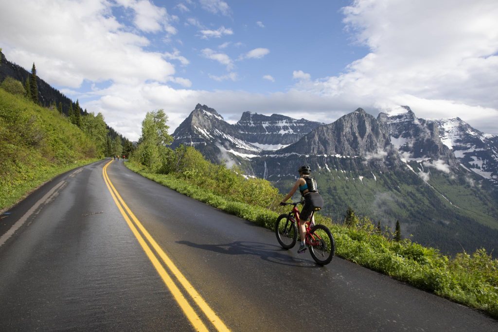
1. GOING-TO-THE-SUN ROAD
Level: Intermediate to Advanced (Road)
Length: Varies
Cycling Going-to-the-Sun Road in spring offers a rare opportunity to experience Glacier National Park before the road opens fully to vehicle traffic. Typically accessible to cyclists from early May through late June, depending on snow conditions, this iconic route reveals waterfalls, alpine scenery and quiet stretches of pavement.
Biking is permitted on all park roads (and select trails), though conditions can change quickly. Once the Going-to-the-Sun Road opens to vehicles, cyclists should expect heavy traffic and seasonal riding restrictions on certain sections during peak daytime hours. Check National Park Service updates before riding and be prepared for variable weather. Contact Glacier Guides or other local outfitters for bike rentals, guided bike tours and unforgettable custom Glacier National Park adventures.
2. WHITEFISH DOWNTOWN MULTI-USE PATHS
Level: Beginner (Road/Path)
Length: Varies
Whitefish’s paved bike and pedestrian paths follow the Whitefish River through town near Riverside Park, connecting parks, neighborhoods and downtown shops. Spring offers a quieter window to explore this resort community before summer crowds arrive, making it an easy and scenic ride for all ages.
3. LAKE KOOCANUSA LOOP
Level: Intermediate to Advanced (Road)
Length: 83 miles
This scenic loop circles Lake Koocanusa, beginning near Libby and following Forest Service Road 228 (Scenic Byway 37) along the lake before crossing the Rexford Bridge and returning via Highway 37. Moderate climbs are rewarded with expansive lake views and forested shoreline. Riders should be prepared for remote stretches and changing spring conditions.
4. RON MACDONALD RIVERFRONT TRAIL SYSTEM
Level: Beginner (Road/Path)
Length: Approximately 7 miles
This paved riverfront route follows the Clark Fork River through Missoula, weaving past downtown, parks and pedestrian bridges. Riders can connect to the Kim Williams Nature Trail for additional mileage. With multiple access points on both sides of the river, it’s an ideal option for a relaxed spring ride through one of Western Montana’s cultural hubs.
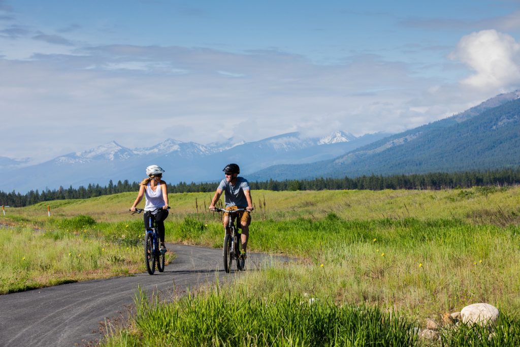
5. BITTERROOT TRAIL
Level: Beginner (Road/Path)
Length: 50 miles
The paved Bitterroot Trail runs from Missoula to Hamilton, following the Bitterroot River between the Bitterroot and Sapphire mountain ranges. Cyclists pass through the communities of Lolo, Florence, Stevensville and Victor, with opportunities to stop at coffee shops, bakeries, breweries and riverside access points.
6. CEDAR FLATS TRAIL NETWORK
Level: Beginner (Mountain)
Length: Approximately 6 miles
Located near Columbia Falls, this trail system offers flowing turns, gradual climbs and loop options well suited for early-season mountain biking. Its proximity to town makes it an accessible choice for short rides or skill-building sessions.
7. WHITEFISH TRAIL: BEAVER LAKES AREA
Level: Beginner to Intermediate (Mountain)
Length: Approximately 13 miles
The Beaver Lakes area of the Whitefish Trail system features rolling singletrack, multiple loop options and scenic views of forested hills and small lakes. With varied terrain and manageable elevation changes, it’s a popular spring destination once the trails have dried.
8. CLARK FORK RIVER TRAIL #233
Level: Intermediate to Advanced (Mountain)
Length: Approximately 9 miles
This singletrack route near St. Regis winds through old-growth forest and open meadows. The route begins with a few challenging switchback climbs, but the majority of the trail flows swiftly along the Clark Fork River. Spring brings wildflowers and quieter conditions. Riders should check trail conditions and be prepared for changing weather.
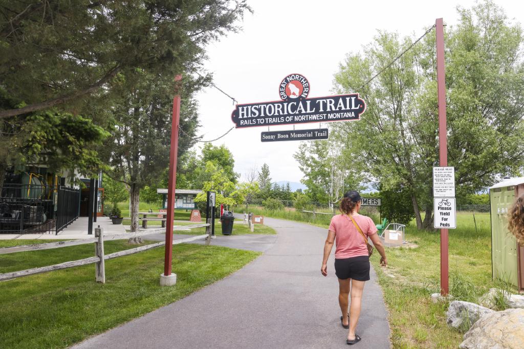
9. THE GREAT NORTHERN HISTORICAL TRAIL
Level: Beginner (Road/Path)
Length: 22 miles
This paved rail-trail corridor connects Somers, Kalispell and Kila, offering wide-open views of the Swan, Mission, Salish and Whitefish mountain ranges. Murals painted inside trail tunnels add visual interest along the route. With gentle grades and multiple access points, it’s well-suited for casual spring riding.
AVOID MUDDY TRAILS
Spring conditions can leave trails soft and muddy. Riding in mud creates ruts that harden as trails dry, damaging the trail for everyone. If it’s muddy, please wait to ride.
Please note: We ask that all our visitors and residents recreate responsibly by being mindful of the following: know before you go; plan ahead; play it safe; leave no trace; tread lightly; and help build an inclusive outdoors.
Updated April 2, 2026
March 21, 2018
Related: Bigfork, Biking, Bitterroot Valley, Darby, Eureka, Getting Around, Glacier National Park, Hamilton, Kalispell, Libby, Missoula, Montana, Outdoor Fun, Paradise, Parks, Spring Fun, St. Regis, Summer Fun, West Glacier, Whitefish
Comments