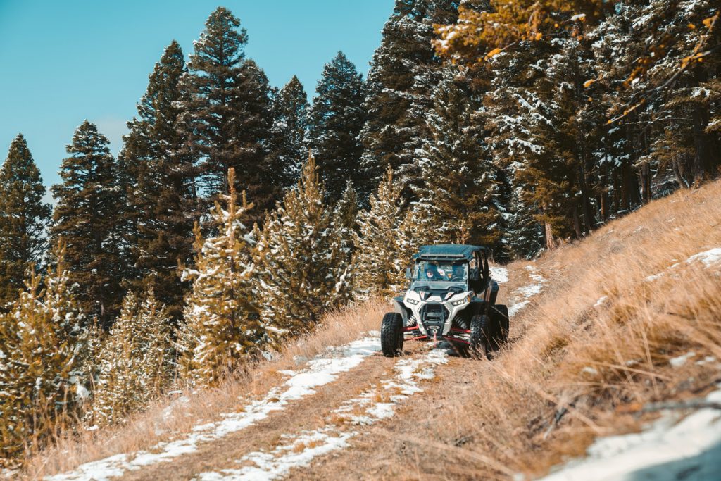
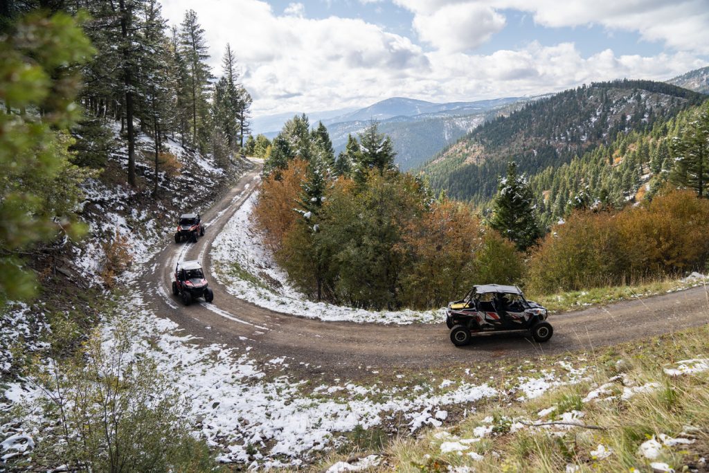
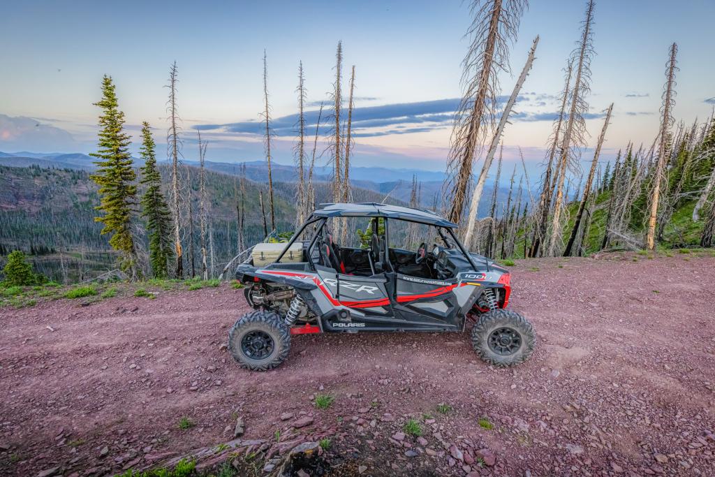
Western Montana’s Glacier Country offers endless opportunities for OHV (off-highway vehicle) exploration, with miles of old Forest Service roads winding through alpine forests, mountain passes and wide-open country. Riders can expect everything from rugged climbs to wide vistas, making this a bucket-list setting for anyone who loves to get off the pavement. And for those new to the sport, local outfitters make it easy with rentals and guided tours. Here’s where—and how—to embark on an off-road adventure in Western Montana.
TREAD LIGHTLY
Recreate responsibly—for your own safety, the safety of others and the protection of Montana’s landscapes. Familiarize yourself with off-roading best practices and safety tips, as well as Tread Lightly principles.
- Travel only in areas open to OHVs.
- Stay on designated routes and avoid sensitive areas such as meadows, lakeshores, wetlands and streams.
- Don’t mix riding with alcohol or drugs.
- Buddy up with two or three drivers. Driving solo can leave you vulnerable if you have an accident or breakdown. Designate meeting areas in case of separation.
- Respect the rights of others, including private property owners, recreational trail users and campers, so they can enjoy their recreational activities undisturbed.
- Do your part by modeling appropriate behavior, leaving the area better than you found it, properly disposing of waste, minimizing the use of fire, avoiding the spread of invasive species and restoring degraded areas.
KNOW BEFORE YOU GO
To ride your OHV on public land or trails in Montana, it must be registered in your home state. A decal for off-road use must be displayed in a conspicuous location on your OHV. Nonresidents using their OHVs in Montana must purchase an annual Nonresident Temporary Use Permit. Montanans must purchase an OHV Resident Trail Pass, which is valid for up to two calendar years. For information on OHV registration and trail passes, for residents and nonresidents, visit Montana Fish, Wildlife & Parks.
OHV RENTALS
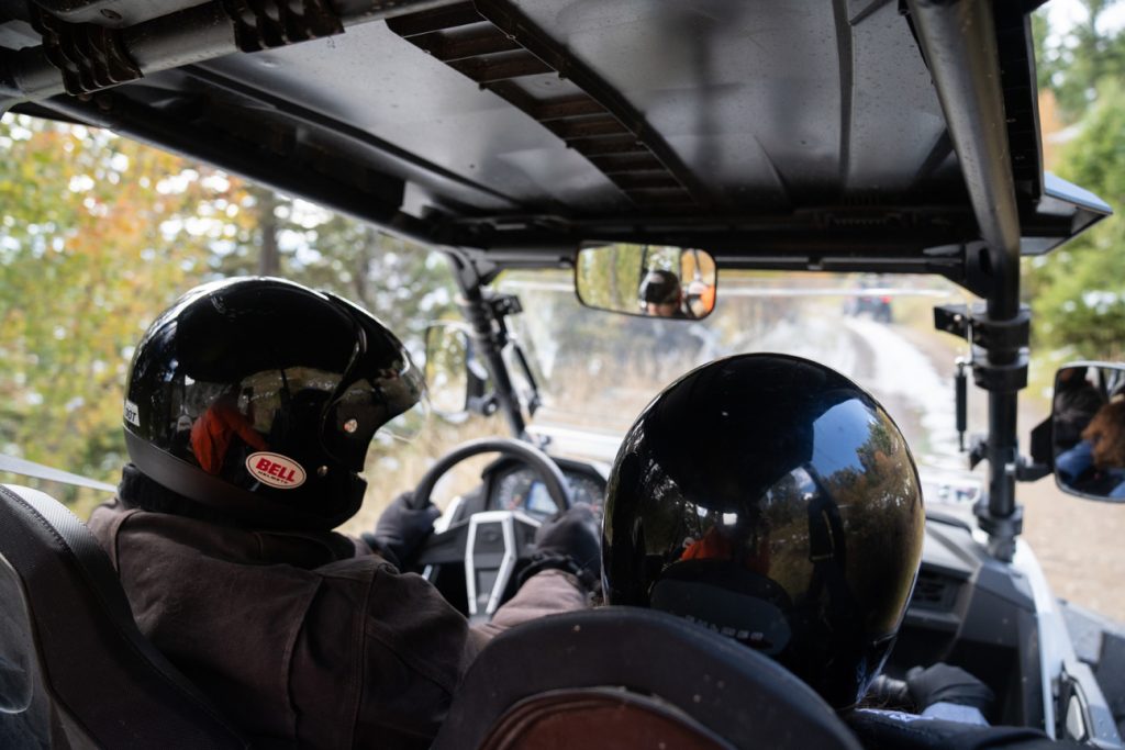
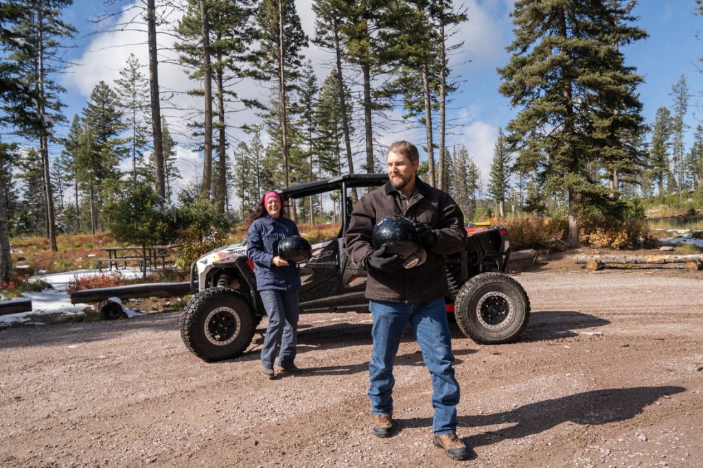
You can rent off-road vehicles at various outfitters throughout the region, and some outfitters also offer guided rides. Always ensure you wear protective gear, including a helmet, while off-roading. This gear should be available for rent with your vehicle, but please call ahead to confirm. Also, note that rental shops are great sources of information. You can ask them about the terrain and trails, including which ones are best suited for your experience level. Most rentals come with digital GPS trail maps, allowing people to enjoy the ride without worrying about getting lost.
Here are a few local outfitters and rental companies for OHV rentals: Flathead Off-Road Rentals, Glacier Ridge Runners and Seeley Adventures.
GARNET BACKCOUNTRY BYWAY
Open: Year-round (weather dependent)
Northeast of Missoula near Greenough, the Garnet Backcountry Byway provides a 12-mile ride through the Garnet Mountains. Enjoy outstanding views of the Blackfoot River Valley, the Swan Range, the Mission Mountains and the Bob Marshall Wilderness, and visit Garnet Ghost Town—one of the best preserved ghost towns in Montana.
Getting There: Garnet Range Road is accessible from Highway 200 about 30 miles east of Missoula. The route ends at its junction with another BLM service road at Elk Creek. The Garnet Range Road is closed from January 1 through March 31 except for all forms of over-snow transportation.
SEELEY LAKE AREA TRAILS
Open: Year-round (weather dependent)
Ride east from Seeley Lake in the Lolo National Forest on Cottonwood Lakes Road and Rice Ridge Road all the way to Frenchtown. Both winding Forest Service roads offer exceptional views of one of the region’s most beautiful destinations.
Getting There: Both roads are accessible from State Highway 83.
BLACKTAIL WILD BILL OHV TRAIL
Open: Year-round (weather dependent)
Choose-your-own adventure: This 10-mile trail near Lakeside offers bypasses on all of its challenging features, so take your pick of obstacles. Enjoy scenic vistas of Flathead Lake and the surrounding mountains. There are three trailheads to access the Blacktail OHV system.
Trail #917 – Getting There: From U.S. Highway 93 near Lakeside, turn west onto Blacktail Road (after turning, turn left immediately, before the hardware store). Continue up Blacktail Road, which turns into Forest Service Road #917 for about 12 miles. The trailhead is on the left.
Trail #918 – Getting There: This trail can be accessed from the north via Highway 2 or from Lakeside.
Trail #919 – Getting There: From State Highway 2, turn onto Kila Road for about 1.8 miles; going through Kila, turn left onto Smith Lake Road (2/10mile), turn right onto Browns Meadow Road (1 mile), turn left onto Truman Creek Road (2.3 miles), turn right onto Wild Bill Road after the pavement ends, continue up this road about 2.7 miles, and then turn left onto the designated access road (which resembles a private driveway) for 1/10 of a mile. The trailhead is on the right. There is wooden three-rail fencing on the left side of the drive. If you pass a road on the left (#9662) with an open field on the right, you’ve gone just a little too far.
ASHLEY LAKE ATV TRAIL #812
Open: June – October
This local favorite west of Kalispell is popular in the summertime, but if you’re looking for a quieter ride, venture over in the late spring or early fall before big-game hunting season begins. The trail, located just north of Ashley Lake, offers 7 miles of scenic ATV terrain, and the lake itself provides off-trail recreation opportunities, including swimming, fishing and camping.
Getting There: From Kalispell, take U.S. Highway 2 west for 4 miles, turn onto Ashley Lake Road (Forest Service Road #912) for 15 miles, then turn onto Forest Service Road #10236 for about 4 miles. The trailhead is marked with signs.
KOOCANUSA SAND DUNES AND TRAIL SYSTEM
Open: Year-round (weather dependent)
Mix things up in the dunes and play pits of this large, open area at the northeast corner of the Koocanusa Reservoir, best accessed late March through late June when the water levels are low. You’ll also find 20 miles of trails that lead into the surrounding woods. This area is actually the original site of the city of Rexford. Please note that there are American Indian burial grounds in the area. They are well-marked and closed to riding—be respectful.
Getting There: From Eureka, take U.S. Highway 93 north for 5 miles to State Route 37. Take a left on MT-37 for 2.2 miles, then veer right onto Douglas Hill Road for half a mile, turn right onto Sophie Lake Road for 1 mile, veer left onto Iowa Flats Road for .1 miles, and then turn right onto Sophie Lake Road for 3.5 miles toward the lake.
DARBY TRAILS — BITTERROOT NATIONAL FOREST
Open: Year-round (weather dependent)
The Bitterroot National Forest has 50 miles of trails open to ATVs, including two loops—#1, a 28-mile loop, and #2, a 15-mile loop—on the old Darby Lumber Lands, also south of Darby. This trail system is popular with beginner and intermediate riders, and the views are spectacular.
Getting There: From Darby, head south on U.S. Highway 93 for about 4 miles and take a left on Rye Creek Road. For Loop #1, take Rye Creek Road for 4 miles to North Fork Rye Creek Road/North Fork Road, where you’ll take a left and drive for about 6 miles until you reach Road #1127 and the trailhead. For Loop #2, take Rye Creek Road for 6 miles. Before the Rock Creek Road divide, you’ll see a parking area on the left with signage for Loop #2.
Please note: We ask that all our visitors and residents recreate responsibly by being mindful of the following: know before you go; plan ahead; play it safe; leave no trace; tread lightly; and help build an inclusive outdoors.
September 29, 2025
Related: Darby, Greenough, Kalispell, Lakeside, Montana, Off Roading, Outdoor Fun, Recreate Responsibly, Rexford, Seeley Lake, Vacation
Comments