Winter in Western Montana offers a quieter, more contemplative way to experience the region’s extraordinary landscapes. Snow-covered valleys, mountain peaks dusted with white and open stretches of highway create a memorable backdrop for cold-season travel. Whether you set out for a half-day drive, a full-day adventure or an overnight getaway, Glacier Country’s winter roads reveal a fresh perspective on familiar places.
These scenic routes highlight safe, accessible ways to explore the region when winter settles in. Always check current weather and road conditions before heading out, and travel slowly on winding or snow-packed roads.
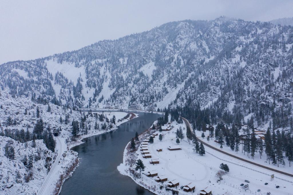
RAVALLI TO ST. REGIS: MONTANA HIGHWAY 200 AND THE ST. REGIS–PARADISE SCENIC BYWAY, 53 MILES
From Ravalli, follow Highway 200 west along the Flathead River as it winds through a quiet valley lined with winter views. Pass through Sčilíp and Perma—small communities surrounded by open fields and mountain foothills—before the landscape begins to rise dramatically around you.
Turn south onto Highway 135 to follow the Clark Fork River along the St. Regis–Paradise Scenic Byway. A stop at Quinn’s Hot Springs Resort offers warm pools and dining at the historic Harwood House Restaurant. Continue on to St. Regis for fuel, a meal and a visit to the St. Regis Travel Center, where travelers can view a trout aquarium and enjoy a huckleberry shake.
MISSOULA TO SULA: U.S. HIGHWAY 93, 82 MILES
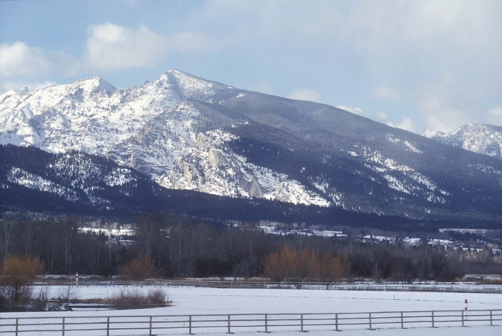
Highway 93 traces the length of the Bitterroot Valley, offering winter views of prominent peaks including Lolo Peak and St. Mary Peak. Begin in Missoula and travel south to Lolo, where Travelers’ Rest State Park provides a window into Lewis and Clark Expedition history. By appointment, visitors can also explore the Holt Heritage Museum, which highlights cowboy culture and regional history.
Continue through Florence, Stevensville and Victor to reach Hamilton, the valley’s largest community. South of town, turn onto Lake Como Road for winter views of Lake Como, framed by Western Montana’s El Capitan and West Como Peak. Road and trail conditions vary by season, so always check with the Bitterroot National Forest before venturing farther.
Follow Highway 93 toward Darby, a small town with dining and lodging options, including Rye Creek Lodge. The highway then climbs toward Lost Trail Pass, offering access to downhill skiing, Nordic trails, snowshoeing and winter hiking at Lost Trail Powder Mountain and Chief Joseph Pass.
HIGHWAY 12 SCENIC DRIVE, 70 MILES
Highway 12 west of Lolo weaves through the forested terrain of the Lolo National Forest. In winter, the route is quiet and heavily wooded, following West Fork Lolo Creek beneath steep, tree-covered slopes.
Stop at Travelers’ Rest State Park before continuing west, or plan a visit to Lolo Hot Springs Resort for a mineral soak, warm meal or overnight stay. Nearby, Lolo Pass offers snowshoe and cross-country ski trails. This winding mountain road requires careful winter travel; return the same way to enjoy the scenic views from a new angle.
WHITEFISH TO WEST GLACIER, 26 MILES
This well-traveled summer route takes on a peaceful character in winter. Begin in Whitefish, where winter views of Whitefish Lake and opportunities for cold-season recreation—such as fat biking on local trails—set the tone for the day.
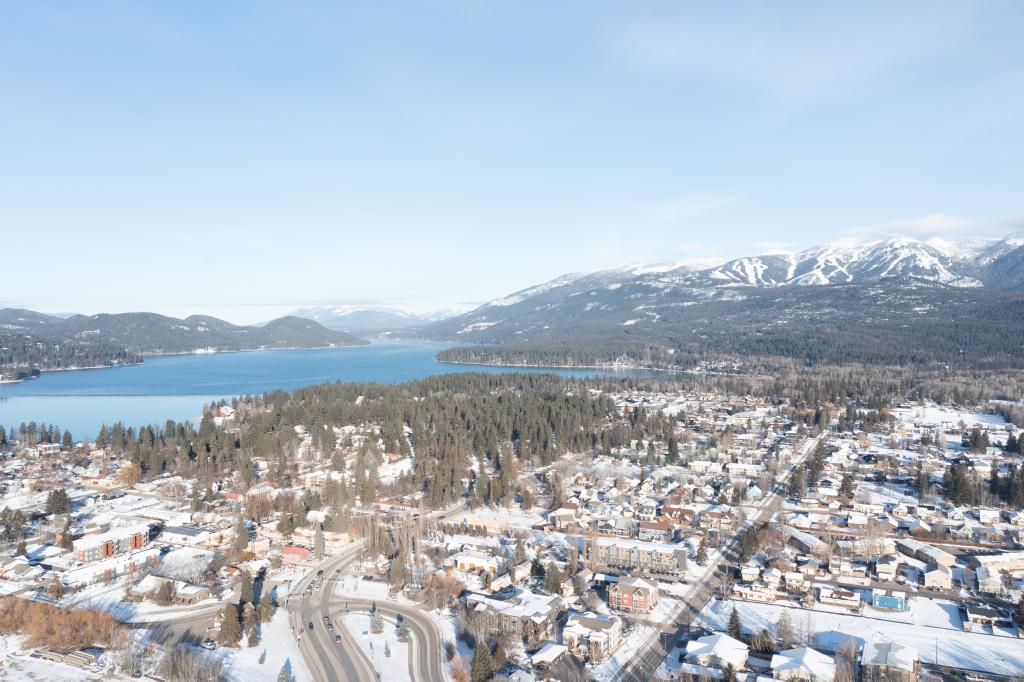
Head south on Highway 93 to Highway 40 toward Columbia Falls, then continue onto Highway 2 as it enters a dramatic canyon carved by the Flathead River. Winter transforms the river corridor into a landscape of snow-covered banks and ice formations.
Stop in Hungry Horse for a slice of homemade pie or fudge at The Huckleberry Patch, or visit Glacier Distilling Company in Coram. Continue through West Glacier for winter access to Glacier National Park. Apgar Village offers access to Lake McDonald’s scenic shoreline when road conditions allow.
WEST GLACIER TO ST. MARY, 97.5 MILES
From West Glacier, head east on Highway 2 through a landscape of prominent mountains—Mt. Furlong, Snowslip Mountain and Calf Robe Mountain. Winter brings quiet to East Glacier Park, where views of the park’s eastern peaks meet the open plains.
Continue east to Browning on Highway 2, and stop at Faught’s Blackfeet Trading Post or the Museum of the Plains Indian for meaningful cultural insight. From Browning, travel north on Highway 89 toward St. Mary, where winter access to Glacier National Park varies depending on road conditions. Always check road status and park updates before entering.
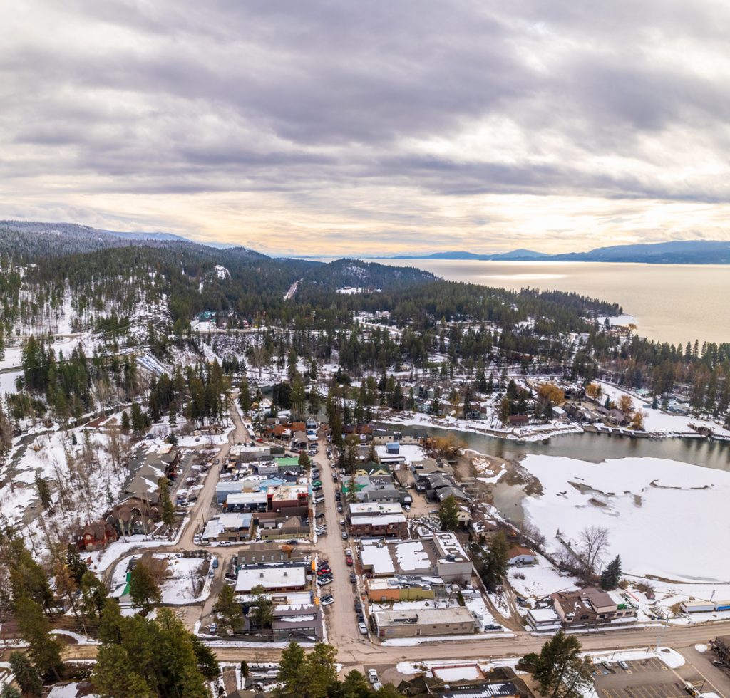
POLSON TO POLSON: FLATHEAD LAKE LOOP, 87.5 MILES
Circling Flathead Lake offers sweeping views of the water framed by snow-covered mountains. From Polson, travel north on Highway 93 toward Big Arm State Park. Continue through Elmo, Dayton and Rollins to reach Lakeside, where lakeside lodging and dining add to the winter experience.
From Lakeside, continue north to Somers before turning east on Highway 82. After crossing the Flathead River, turn south on Highway 35. The road passes through Bigfork—a little sleepy this time of year, but known for galleries, restaurants and a local brewery—and continues toward Wayfarers/Flathead Lake State Park, where winter light creates striking lake views.
Proceed south past Woods Bay to Finley Point Grill, an excellent stop for dinner before returning to Polson. Drive carefully, as this two-lane road can be narrow and winding.
WINTER DRIVING SAFETY TIPS
- Check out the Montana Department of Transportation’s Travel Map for up-to-date road conditions.
- Travel with sleeping bags, blankets, extra water and food, extra warm clothes, and plan ahead for where cell service may be spotty or nonexistent.
- Make sure your vehicle is well-maintained: working headlights and taillights, coolant, windshield wipers, tire pressure, etc.
- Take it slow! Road conditions may change quickly.
- Keep an eye out for wildlife crossing the road
- Assign a designated driver if consuming alcohol.
- Refuel when you can—in some areas, gas stations can be few and far between.
- Always check business hours for weather-related closings or changes.
Please note: We ask that all our visitors and residents recreate responsibly by being mindful of the following: know before you go; plan ahead; play it safe; leave no trace; tread lightly; and help build an inclusive outdoors.
Updated March 31, 2026
January 17, 2018
Related: American Indian, Big Arm, Bigfork, Bitterroot Valley, Blackfeet Indian Reservation, Blackfeet Nation, Browning, Clark Fork Corridor, Columbia Falls, Coram, Darby, Dayton, Dixon, East Glacier Corridor, Elmo, Essex, Family Fun, Flathead Corridor, Flathead Indian Reservation, Flathead Lake, Florence, Getting Around, Glacier National Park, Hamilton, Hot Springs, Hungry Horse, Lakeside, Lolo, Montana, Outdoor Fun, Paradise, Parks, Polson, Ravalli, Road Trips, Rollins, Somers, St. Mary, St. Regis, Stevensville, Sula, Vacation, Victor, West Glacier, Whitefish, Wildlife, Winter Fun
Comments